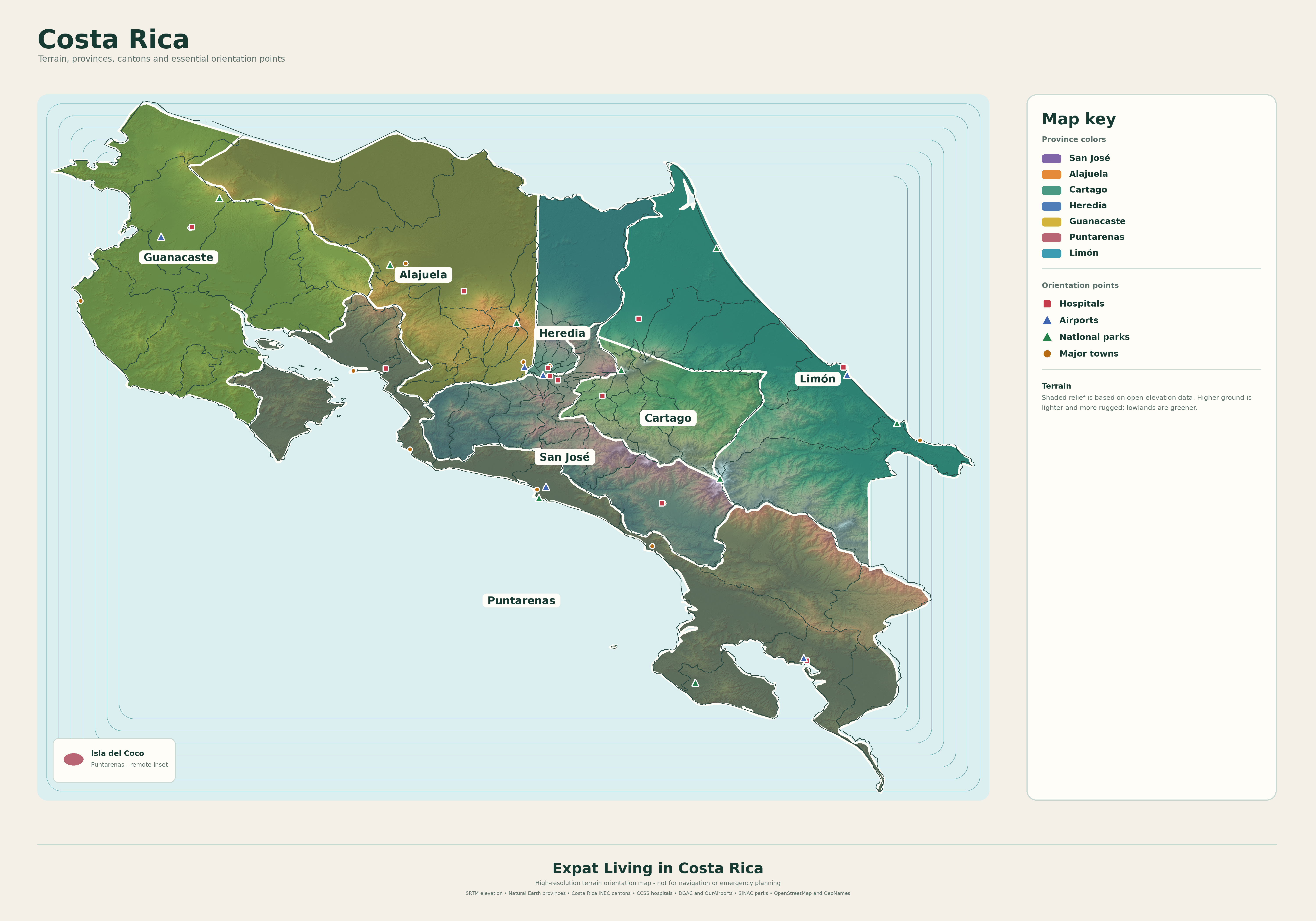
The seven provinces
Costa Rica is divided into San José, Alajuela, Cartago, Heredia, Guanacaste, Puntarenas and Limón. Provincial boundaries help organize the map, but they do not create one uniform lifestyle.
- San José: dense urban services and varied southern highlands
- Alajuela: airport access, western valley towns and large northern areas
- Cartago: cooler highlands, agriculture and eastern valley communities
- Heredia: Central Valley access with urban and mountain settings
- Guanacaste: drier northwest, beaches and strong tourism influence
- Puntarenas: a long Pacific province with very different central and southern zones
- Limón: Caribbean climate, port activity and culturally distinct communities
Compare practical access
Distance alone is a poor measure of convenience. Mountains, congestion, road conditions and weather can make a short route slow. Think in dependable travel time to the places you will use repeatedly.
- Hospital and specialist care
- International airport
- Supermarket, pharmacy and bank
- Family or social community
- Road alternatives during closures
- Public transportation if you stop driving
Climate follows terrain
Elevation can cool temperatures quickly. Rainfall patterns differ between the Pacific and Caribbean sides, and local valleys and mountain passes create additional variation. Test the exact area in more than one season.
A province-level climate description is orientation, not a forecast for a specific home.
Use the map, then go smaller
The terrain map can help you understand provinces, cantons, towns and selected services. Your next layer of research should be the actual route, neighborhood, rental market and property elevation.
Central Valley or coast? Start with your routine
The coast may fit someone whose days revolve around the ocean and outdoor activities. A valley town may fit someone who values access to appointments, shopping and urban services. Neither description tells you the full cost or comfort of an individual property.
Make the comparison using the same week: groceries, two appointments, a social activity, a repair and an airport trip. Record the travel time and cost in each location. A cheaper rental may lose its advantage if routine travel becomes expensive or tiring.
How to inspect a neighborhood
Visit during a weekday morning, evening and weekend. Listen for traffic, dogs, music and commercial activity. Check whether the walk to shops has continuous sidewalks and safe crossings. Ask about water supply, power interruptions and actual internet performance.
Talk with more than one resident, including someone who has experienced a rainy season there. Write down what you observed personally and what remains a secondhand report. You do not have to reject a place because it has drawbacks; you do need to know whether those drawbacks are manageable.
Common questions
What is the best place to retire in Costa Rica?
There is no universal best place. Compare the exact neighborhood against healthcare, transport, climate, budget and community needs.
Should I choose the town before the house?
Define your practical needs first, compare towns next and inspect individual homes last. An attractive house cannot remove an unsuitable commute or climate.